RADAR stands for “Radio Detection and Ranging.” It is a technology that uses radio waves to detect and locate objects, both stationary and moving. RADAR systems work by transmitting radio waves and then measuring the time it takes for the waves to bounce back after hitting an object. This time delay, along with the properties of the reflected waves, can provide information about the object’s distance, speed, size, and even its shape.
Navigation and Communication Equipment’s
RADAR


VHF
VHF stands for “Very High Frequency.” It refers to a range of radio frequencies commonly used for various communication and broadcasting purposes. VHF frequencies range from 30 megahertz (MHz) to 300 MHz, which places them in the lower part of the radio frequency spectrum.
ECDIS
ECDIS stands for Electronic Chart Display and Information System. It is a computer-based navigation system used in the maritime industry to assist navigators in making safe and efficient decisions while navigating a vessel. ECDIS is a critical tool for modern navigation and is considered a significant advancement over traditional paper nautical charts.


MF HF
MF and HF stand for Medium Frequency and High Frequency, respectively. These are two bands within the radio frequency spectrum that have specific uses and characteristics:
- Medium Frequency (MF):
- Frequency Range: MF radio waves typically cover the range from 300 kilohertz (kHz) to 3 megahertz (MHz).
- Characteristics: MF signals are capable of traveling over long distances, and they are known for their ability to follow the curvature of the Earth’s surface, a phenomenon known as groundwave propagation. This makes MF suitable for some long-distance communication purposes.
- Applications: MF has historically been used for AM (Amplitude Modulation) broadcasting and maritime communication. However, AM broadcasting has largely transitioned to higher frequency bands like FM (Frequency Modulation) in many regions. MF is still used in maritime radio for long-distance communication, especially for vessels operating in remote areas or on the open ocean.
- High Frequency (HF):
- Frequency Range: HF radio waves cover the range from 3 megahertz (MHz) to 30 megahertz (MHz).
- Characteristics: HF signals have the ability to propagate long distances by reflecting off the Earth’s ionosphere. This is known as skywave propagation. Because of this, HF radio is often used for long-range communications, especially over-the-horizon communication where line-of-sight is not possible.
- Applications: HF radio is widely used in long-distance communication, especially in the field of amateur radio (ham radio) for global communication. It is also commonly used in military and aviation communication, as well as for emergency communication during disasters when other forms of communication may be disrupted.
In summary, MF and HF are specific frequency bands within the radio spectrum, each with its own set of characteristics and applications. While MF is known for its groundwave propagation and has applications in maritime communication, HF is notable for its skywave propagation and is used for long-range communication in various fields, including amateur radio, military, and emergency communication.
INMARSAT C
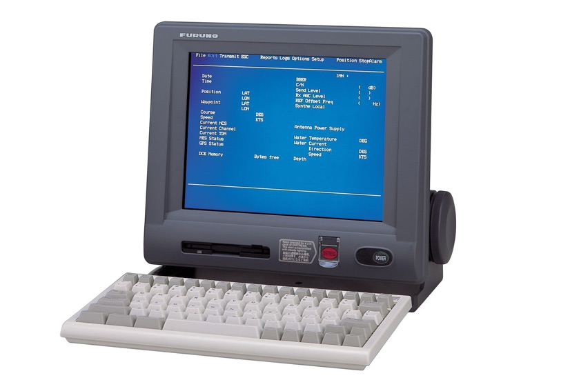
INMARSAT C is a global satellite communication system primarily used for sending and receiving short data messages and maritime safety information. It is part of the broader suite of satellite services provided by INMARSAT (International Mobile Satellite Organization), a leading provider of global satellite communications.

FleetBroadband
FleetBroadband (FB) is a maritime satellite communication service provided by INMARSAT (International Mobile Satellite Organization). It offers high-speed data and voice communication services to ships and vessels operating at sea. FleetBroadband is designed to meet the growing demands of modern maritime communications, providing reliable connectivity for both operational and crew welfare purposes.
FleetBroadband has become an essential tool for the maritime industry, helping vessels and shipping companies stay connected and operate more efficiently. It provides a lifeline for communication, safety, and operational needs in an industry that relies on reliable connectivity, especially for vessels operating in remote or international waters.
WEATHER FAX
Weather fax, short for “weather facsimile,” is a method of transmitting weather charts, satellite images, and other meteorological information over radio frequencies to ships, aircraft, and other users. It’s a way to provide visual
weather data to remote locations, particularly at sea.
In summary, weather fax is a technology used for transmitting visual weather data over radio frequencies. It has been an important tool in maritime and remote environments, although it has been partially replaced by digital communication methods in recent years. It remains relevant for certain applications, particularly in situations where simplicity and reliability are essential.


GPS
GPS, or Global Positioning System, is a satellite-based navigation system that allows users to determine their precise location and track their movement anywhere on Earth. It is a critical technology used in various applications, including navigation, mapping, surveying, and timing synchronization.
ECHO SOUNDER
An echo sounder, also known as a depth sounder or sonar, is a device used for measuring the depth of water by transmitting sound waves into the water and measuring the time it takes for the sound waves to bounce off the seabed or other underwater objects and return to the surface.


NAVTEX:
NAVTEX, short for “Navigational Telex,” is an international automated system for broadcasting maritime safety information and navigational warnings to ships at sea. It is an essential tool for communicating critical information to vessels to ensure their safety and facilitate efficient navigation.
GMDSS WALKIE-TALKIES
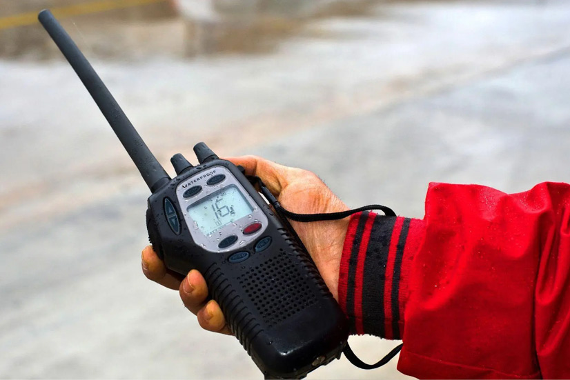
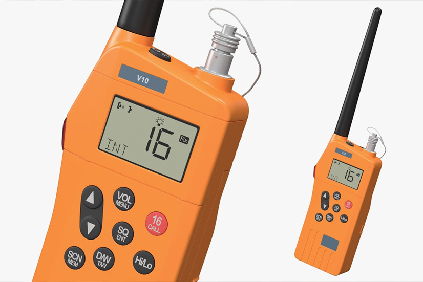
Walkie-talkies, also known as two-way radios, are portable handheld communication devices that allow users to transmit and receive voice messages over short to medium distances without the need for a centralized network or infrastructure. While walkie-talkies are commonly used in various industries and recreational activities, they are not typically part of the Global Maritime Distress and Safety System (GMDSS), which is a specialized and internationally regulated system for maritime communication.

WALKIE-TALKIES
Walkie-talkies, also known as two-way radios, are portable communication devices that allow users to transmit and receive voice messages wirelessly over short to medium distances. They are widely used in various applications where real-time communication between individuals or groups is needed.
GYRO
A gyro, short for gyroscope, is a device that is used to measure or maintain orientation and angular velocity. Gyroscopes are widely employed in various fields, including navigation, engineering, aviation, and space exploration. They are based on the principles of angular momentum and the conservation of angular momentum.


SPEED LOG
A speed log, also known as a ship’s log or ship’s speedometer, is an instrument used to measure and display the speed of a vessel through water. It is an essential navigational tool for ships and boats, providing real-time information about a vessel’s speed, which is crucial for safe and efficient navigation.
SART
A Search and Rescue Transponder, often abbreviated as SART, is a vital piece of safety equipment used in the maritime industry and aviation to aid in locating and rescuing distressed vessels, aircraft, or individuals at sea. SARTs are a crucial component of the Global Maritime Distress and Safety System (GMDSS) and are designed to enhance search and rescue operations.


EPIRB
An Emergency Position-Indicating Radio Beacon (EPIRB) is a critical distress alerting and locating device used in maritime and aviation emergencies. EPIRBs are designed to transmit a distress signal to search and rescue authorities, providing information about the location of the vessel or aircraft in distress.
VDR/SVDR
A Voyage Data Recorder (VDR) and a Simplified Voyage Data Recorder (SVDR) are specialized onboard data recording systems used in the maritime industry to enhance safety, assist accident investigations, and improve the overall operational efficiency of vessels. Here are the key aspects of VDRs and SVDRs:

SAT COMPASS
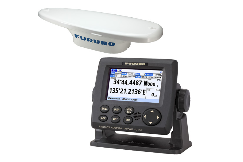
A satellite compass, often referred to as a GPS compass or GNSS (Global Navigation Satellite System) compass, is a sophisticated navigation device that uses signals from multiple satellites to determine precise headings and navigational information. Unlike traditional compasses, which rely on the Earth’s magnetic field, satellite compasses provide accurate information regardless of magnetic disturbances or geographic location.
AIS
AIS, or Automatic Identification System, is a technology used in the maritime industry to improve the safety and efficiency of vessel traffic. AIS enables ships and shore-based stations to exchange real-time information about their identity, position, course, and speed. Here are key aspects of AIS:


AUTO PILOT
An autopilot is a sophisticated electronic system used in various vehicles, including aircraft, ships, and even automobiles, to control and steer the vehicle without direct human intervention. Autopilots are designed to assist and relieve the human operator from the constant manual control of the vehicle, allowing them to focus on other tasks or reduce fatigue during long journeys.
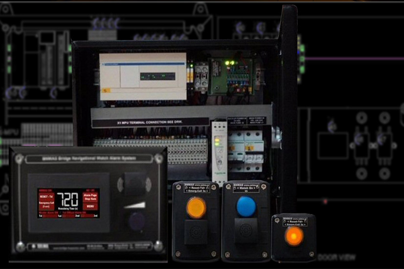
BNWAS
Bridge Navigational Watch Alarm System (BNWAS) is a safety system installed on vessels to monitor the bridge (navigational) watch and ensure that a proper lookout is maintained at all times, especially during periods when the ship is at sea. BNWAS is an important safety measure designed to prevent accidents and collisions caused by inattentiveness or fatigue of bridge watch personnel.

REPROGRAMMING
Reprogramming refers to the process of modifying or updating the software or firmware of a computer, electronic device, or system to change its behavior, add new features, fix issues, or improve performance. Reprogramming can be applied to a wide range of devices and systems, from smartphones and computers to embedded systems, microcontrollers, and industrial machinery.
RETROFITS
Weather fax, short for “weather facsimile,” is a method of transmitting weather charts, satellite images, and other meteorological information over radio frequencies to ships, aircraft, and other users. It’s a way to provide visual
weather data to remote locations, particularly at sea.
In summary, weather fax is a technology used for transmitting visual weather data over radio frequencies. It has been an important tool in maritime and remote environments, although it has been partially replaced by digital communication methods in recent years. It remains relevant for certain applications, particularly in situations where simplicity and reliability are essential.


INTERCOM (PAGING)AND TELEPHONE SYSTEM
ntercom and telephone systems are communication systems used in various settings, such as homes, businesses, institutions, and industrial facilities, to facilitate voice communication among individuals or different parts of a building or complex. While both systems serve communication purposes, they have distinct features and applications.
